Geolocate

Pamacca topographic map

Interactive map

Click on the map to display elevation.

About this map

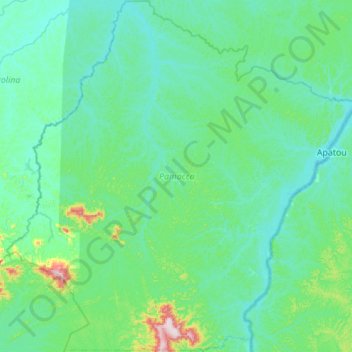
Name: Pamacca topographic map, elevation, terrain.

Location: Pamacca, Sipaliwini, Suriname (4.84523 -54.84938 5.39029 -54.30026)

Average elevation: 62 m

Minimum elevation: 0 m

Maximum elevation: 531 m

Other topographic maps

Click on a map to view its topography, its elevation and its terrain.

Bosland

Suriname > Brokopondo > Brokopondo Centrum

Average elevation: 24 m

Ovillanhollo

Suriname > Marowijne > Patamacca

Average elevation: 16 m

Totness

Suriname > Coronie > Distrikt Coronie > Totness

Average elevation: 2 m

Kabalebo

Suriname > Sipaliwini

Average elevation: 133 m

Palm Islands

Suriname > Commewijne

Average elevation: 3 m

Tammenga

Suriname > Paramaribo > Tammenga > Tammenga

Average elevation: 4 m