
Andorra topographic map
Interactive map
Click on the map to display elevation.
About this map
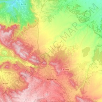
Name: Andorra topographic map, elevation, terrain.
Location: Andorra, Andorra-Sierra de Arcos, Teruel, Aragon, 44500, Spain (40.94302 -0.52736 41.08771 -0.34188)
Average elevation: 626 m
Minimum elevation: 358 m
Maximum elevation: 868 m