
Make a donation
Gear up for your next adventure:
As an Amazon Associate, this site earns from qualifying purchases at no extra cost to you.
Feldis topographic map
Click on the map to display elevation.
Make a donation
Gear up for your next adventure:
As an Amazon Associate, this site earns from qualifying purchases at no extra cost to you.
Feldis
The municipality is located in the Domleschg district. It is a Haufendorf (an irregular, unplanned and quite closely packed village, built around a central square) on a terrace at an elevation of 1,469 m (4,820 ft) on the eastern side of the Hinterrhein valley. Until 1943 Feldis/Veulden was known as Feldis.
Make a donation
Gear up for your next adventure:
As an Amazon Associate, this site earns from qualifying purchases at no extra cost to you.
About this map
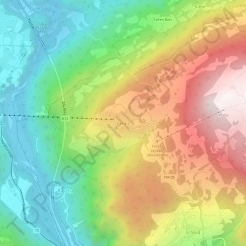
Name: Feldis topographic map, elevation, terrain.
Location: Feldis, Domleschg, Viamala, Grisons, 7404, Switzerland (46.77446 9.41230 46.81446 9.45230)
Average elevation: 1,186 m
Minimum elevation: 587 m
Maximum elevation: 1,996 m
Make a donation
Gear up for your next adventure:
As an Amazon Associate, this site earns from qualifying purchases at no extra cost to you.