
Canaan topographic map
Interactive map
Click on the map to display elevation.
About this map
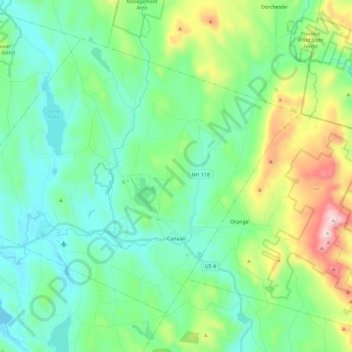
Name: Canaan topographic map, elevation, terrain.
Location: Canaan, Grafton County, New Hampshire, 03741, United States (43.61138 -72.16201 43.74158 -71.93197)
Average elevation: 404 m
Minimum elevation: 229 m
Maximum elevation: 950 m
Other topographic maps
Click on a map to view its topography, its elevation and its terrain.
Stinson Lake
United States > New Hampshire > Grafton County > Rumney > Stinson Lake
Average elevation: 460 m
Mount Kineo, East Peak
United States > New Hampshire > Grafton County > Ellsworth
Average elevation: 710 m
West Lebanon
United States > New Hampshire > Grafton County > Lebanon > West Lebanon
Average elevation: 165 m
North Littleton
United States > New Hampshire > Grafton County > Littleton > North Littleton
Average elevation: 333 m
LeBruns Mobile Home Park
United States > New Hampshire > Grafton County > Lebanon > LeBruns Mobile Home Park
Average elevation: 326 m