
Whare Flat topographic map
Interactive map
Click on the map to display elevation.
About this map
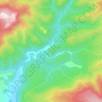
Name: Whare Flat topographic map, elevation, terrain.
Location: Whare Flat, Dunedin, Dunedin City, Otago, New Zealand (-45.83389 170.40031 -45.79389 170.44031)
Average elevation: 231 m
Minimum elevation: 48 m
Maximum elevation: 531 m
Other topographic maps
Click on a map to view its topography, its elevation and its terrain.