
Laiyuan County topographic map
Interactive map
Click on the map to display elevation.
About this map
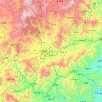
Name: Laiyuan County topographic map, elevation, terrain.
Location: Laiyuan County, Baoding City, Hebei, China (39.02910 114.34753 39.68323 115.08143)
Average elevation: 1,013 m
Minimum elevation: 157 m
Maximum elevation: 2,308 m
Other topographic maps
Click on a map to view its topography, its elevation and its terrain.