
Osceola topographic map
Interactive map
Click on the map to display elevation.
About this map
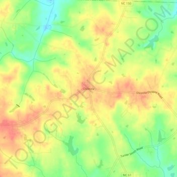
Name: Osceola topographic map, elevation, terrain.
Location: Osceola, Guilford County, North Carolina, United States (36.20791 -79.63558 36.24791 -79.59558)
Average elevation: 236 m
Minimum elevation: 205 m
Maximum elevation: 258 m
Other topographic maps
Click on a map to view its topography, its elevation and its terrain.
Piedmont Heights
United States > North Carolina > Guilford County > Greensboro
Average elevation: 251 m
Melborne Heights
United States > North Carolina > Guilford County > High Point
Average elevation: 256 m