
Ceriana topographic map
Interactive map
Click on the map to display elevation.
About this map
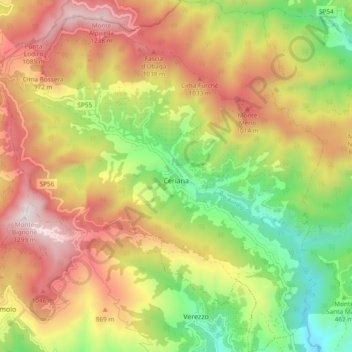
Name: Ceriana topographic map, elevation, terrain.
Location: Ceriana, Provincia di Imperia, Liguria, Italy (43.84755 7.72624 43.91556 7.81419)
Average elevation: 660 m
Minimum elevation: 73 m
Maximum elevation: 1,281 m
Other topographic maps
Click on a map to view its topography, its elevation and its terrain.