
Dahan Qoloni topographic map
Interactive map
Click on the map to display elevation.
About this map
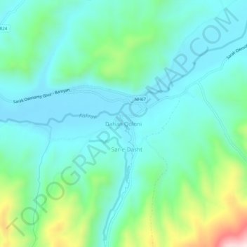
Name: Dahan Qoloni topographic map, elevation, terrain.
Location: Dahan Qoloni, La‘l wa Sar Jangal, Ghor Province, Afghanistan (34.44710 66.21252 34.48710 66.25252)
Average elevation: 2,871 m
Minimum elevation: 2,752 m
Maximum elevation: 3,281 m