
Make a donation
Gear up for your next adventure:
As an Amazon Associate, this site earns from qualifying purchases at no extra cost to you.
Ottmarsheim topographic map
Click on the map to display elevation.
Make a donation
Gear up for your next adventure:
As an Amazon Associate, this site earns from qualifying purchases at no extra cost to you.
About this map
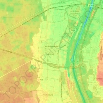
Name: Ottmarsheim topographic map, elevation, terrain.
Average elevation: 224 m
Minimum elevation: 200 m
Maximum elevation: 240 m
Make a donation
Gear up for your next adventure:
As an Amazon Associate, this site earns from qualifying purchases at no extra cost to you.
Other topographic maps
Click on a map to view its topography, its elevation and its terrain.
Vosges
France > Grand Est > Haut-Rhin > Goldbach-Altenbach
Les Vosges sont un massif de moyennes montagnes du Nord-Est de la France qui sépare le plateau lorrain de la plaine d'Alsace. D'origine varisque et majoritairement constituées de grès et de granite, elles atteignent des altitudes culminant à 1 423 mètres au Grand Ballon.
Average elevation: 864 m
Make a donation
Gear up for your next adventure:
As an Amazon Associate, this site earns from qualifying purchases at no extra cost to you.