
Villasur de Herreros topographic map
Interactive map
Click on the map to display elevation.
About this map
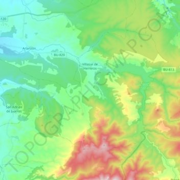
Name: Villasur de Herreros topographic map, elevation, terrain.
Average elevation: 1,151 m
Minimum elevation: 954 m
Maximum elevation: 1,610 m
Other topographic maps
Click on a map to view its topography, its elevation and its terrain.
La Cerca
España > Castilla y León > Villasur de Herreros
La Cerca, Villasur de Herreros, Burgos, Castilla y León, España
Average elevation: 1,408 m