
Thank you for supporting this site ❤️
Make a donation
Make a donation
Gear up for your next adventure:
As an Amazon Associate, this site earns from qualifying purchases at no extra cost to you.
Lozzole topographic map
Click on the map to display elevation.
Thank you for supporting this site ❤️
Make a donation
Make a donation
Gear up for your next adventure:
As an Amazon Associate, this site earns from qualifying purchases at no extra cost to you.
About this map
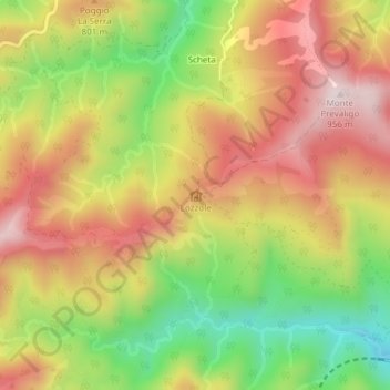
Name: Lozzole topographic map, elevation, terrain.
Location: Lozzole, Palazzuolo sul Senio, Firenze, Toscana, 50035, Italia (44.06125 11.51849 44.08125 11.53849)
Average elevation: 718 m
Minimum elevation: 468 m
Maximum elevation: 935 m
Thank you for supporting this site ❤️
Make a donation
Make a donation
Gear up for your next adventure:
As an Amazon Associate, this site earns from qualifying purchases at no extra cost to you.