Geolocate

Henryville topographic map

Interactive map

Click on the map to display elevation.

About this map

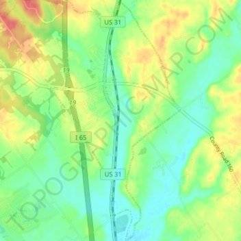
Name: Henryville topographic map, elevation, terrain.

Location: Henryville, Clark County, Indiana, 47126, United States (38.50850 -85.78276 38.55897 -85.74775)

Average elevation: 166 m

Minimum elevation: 144 m

Maximum elevation: 198 m

Other topographic maps

Click on a map to view its topography, its elevation and its terrain.

Sellersburg

United States > Indiana > Clark County

Sellersburg, Clark County, Indiana, 47172, United States

Average elevation: 149 m

Charlestown

United States > Indiana > Clark County

Charlestown, Clark County, Indiana, 47111, United States

Average elevation: 170 m

Jeffersonville

United States > Indiana > Clark County

Jeffersonville, Clark County, Indiana, 47130, United States

Average elevation: 150 m