
Gland topographic map
Interactive map
Click on the map to display elevation.
About this map
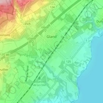
Name: Gland topographic map, elevation, terrain.
Location: Gland, District de Nyon, Waadt, 1196, Schweiz (46.39529 6.25277 46.43953 6.29687)
Average elevation: 421 m
Minimum elevation: 367 m
Maximum elevation: 559 m
Other topographic maps
Click on a map to view its topography, its elevation and its terrain.
Gilly
Schweiz > Waadt > District de Nyon
Gilly, District de Nyon, Waadt, 1182, Schweiz
Average elevation: 604 m
Nyon
Schweiz > Waadt > District de Nyon > Nyon
Nyon, District de Nyon, Waadt, 1260, Schweiz
Average elevation: 404 m
Rolle
Schweiz > Waadt > District de Nyon
Rolle, District de Nyon, Waadt, 1180, Schweiz
Average elevation: 394 m