Geolocate

Colazza topographic map

Click on the map to display elevation.

About this map
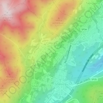
Name: Colazza topographic map, elevation, terrain.

Location: Colazza, Novara, Piedmont, Italy (45.77746 8.47808 45.80306 8.50387)

Average elevation: 582 m

Minimum elevation: 341 m

Maximum elevation: 818 m

Other topographic maps

Click on a map to view its topography, its elevation and its terrain.

Case Sparse di Cameriano

Italy > Piedmont > Novara > Casalino > Cameriano

Average elevation: 141 m

Agrate

Italy > Piedmont > Novara

Average elevation: 324 m

Gaggiolo

Italy > Piedmont > Novara

Average elevation: 211 m

Pisogno

Italy > Piedmont > Novara > Miasino

Average elevation: 527 m

Gear up for your next adventure:

❄️Walking Crampons - Added traction for icy slopes and winter peak bagging
👟Women's Trail Running Shoes - Agile footwear for fell running and technical trails
🧼Biodegradable Soap - Leave-no-trace hygiene for multi-day mountain treks
📐Altimeters & Barometers - Tools for measuring altitude and air pressure
🧦Hiking Socks - Breathable socks designed to prevent blisters on long walks

As an Amazon Associate, this site earns from qualifying purchases at no extra cost to you.