Geolocate

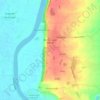
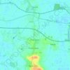
Messingham topographic map

Click on the map to display elevation.

About this map

Name: Messingham topographic map, elevation, terrain.

Location: Messingham, North Lincolnshire, England, DN17 3TB, United Kingdom (53.50916 -0.67302 53.54916 -0.63302)

Average elevation: 17 m

Minimum elevation: 2 m

Maximum elevation: 39 m

North Lincolnshire trails, hiking, mountain biking, running and outdoor activities

Other topographic maps

Click on a map to view its topography, its elevation and its terrain.
Wootton

United Kingdom > England > North Lincolnshire

Average elevation: 45 m

Bonby

United Kingdom > England > North Lincolnshire

Average elevation: 34 m

Broughton

United Kingdom > England > North Lincolnshire

Average elevation: 24 m

Brigg

United Kingdom > England > North Lincolnshire

Average elevation: 6 m

Winterton

United Kingdom > England > North Lincolnshire

Average elevation: 19 m

Horkstow

United Kingdom > England > North Lincolnshire

Average elevation: 37 m

Belton

United Kingdom > England > North Lincolnshire

Average elevation: 4 m

Wroot

United Kingdom > England > North Lincolnshire

Average elevation: 2 m

Appleby

United Kingdom > England > North Lincolnshire

Average elevation: 19 m

Gunness

United Kingdom > England > North Lincolnshire

Average elevation: 3 m

Worlaby

United Kingdom > England > North Lincolnshire

Average elevation: 37 m

Haxey

United Kingdom > England > North Lincolnshire

The civil parish includes the town of Haxey and the village of Westwoodside, and the hamlets of Haxey Carr, High Burnham (the highest elevation of the Isle of Axholme), Low Burnham, East Lound, Graizelound and Upperthorpe which is conjoined to Westwoodside.

Average elevation: 7 m
Broughton

United Kingdom > England > North Lincolnshire

Average elevation: 26 m

Brigg

United Kingdom > England > North Lincolnshire

Average elevation: 6 m

Epworth

United Kingdom > England > North Lincolnshire

Average elevation: 6 m

Winterton

United Kingdom > England > North Lincolnshire

Average elevation: 19 m

Winterton

United Kingdom > England > North Lincolnshire

Average elevation: 19 m

Gear up for your next adventure:

👟Heavy Duty Boot Laces - Always carry a spare for your hiking footwear
🥾Trekking Poles - Poles to improve stability on uneven terrain
🧦Hiking Socks - Breathable socks designed to prevent blisters on long walks
🛰️Handheld GPS Devices - Reliable GPS units for hiking and outdoor navigation
🔥Reusable Hand Warmers - Maintain dexterity in your fingers for precise map handling

As an Amazon Associate, this site earns from qualifying purchases at no extra cost to you.