Geolocate

Port Colborne topographic map

Click on the map to display elevation.

About this map

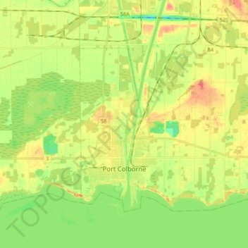
Name: Port Colborne topographic map, elevation, terrain.

Location: Port Colborne, Niagara Region, Ontario, Canada (42.85666 -79.28133 42.95950 -79.11532)

Average elevation: 177 m

Minimum elevation: 156 m

Maximum elevation: 196 m

Other topographic maps

Click on a map to view its topography, its elevation and its terrain.

Horseshoe Falls

Canada > Ontario > Niagara Region > Niagara Falls

Average elevation: 174 m

Fonthill

Canada > Ontario > Niagara Region

Average elevation: 193 m

Bal Harbour

Canada > Ontario > Niagara Region > Grimsby

Average elevation: 83 m

Gear up for your next adventure:

🧺Mesh Stuff Sacks - Breathable storage for wet gear or camp organization
🧴Sport Sunscreen Sticks - High-protection sunblock that won't run into your eyes on the trail
🗺️Topographic Maps - Detailed maps showing elevation and terrain features
🧭Professional Hiking Compasses - High-precision liquid-filled compasses for map reading and orientation
🧊Personal Water Filters - Drink safely from mountain streams marked on your map

As an Amazon Associate, this site earns from qualifying purchases at no extra cost to you.