
Thank you for supporting this site ❤️
Make a donation
Make a donation
Gear up for your next adventure:
As an Amazon Associate, this site earns from qualifying purchases at no extra cost to you.
Kemo topographic map
Click on the map to display elevation.
Thank you for supporting this site ❤️
Make a donation
Make a donation
Gear up for your next adventure:
As an Amazon Associate, this site earns from qualifying purchases at no extra cost to you.
About this map
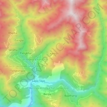
Name: Kemo topographic map, elevation, terrain.
Location: Kemo, Berpa_Khoma, Khoma Gewog, Lhuntse District, Bhutan (27.66756 91.19834 27.74756 91.27834)
Average elevation: 2,153 m
Minimum elevation: 1,225 m
Maximum elevation: 3,194 m
Thank you for supporting this site ❤️
Make a donation
Make a donation
Gear up for your next adventure:
As an Amazon Associate, this site earns from qualifying purchases at no extra cost to you.