
Bray topographic map
Interactive map
Click on the map to display elevation.
About this map
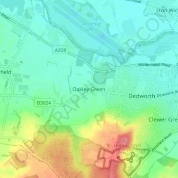
Name: Bray topographic map, elevation, terrain.
Average elevation: 37 m
Minimum elevation: 15 m
Maximum elevation: 90 m
Routes: Royal Borough of Windsor and Maidenhead GPS tracks, routes, trails, hikes
Other topographic maps
Click on a map to view its topography, its elevation and its terrain.
Windsor Marina
United Kingdom > England > Royal Borough of Windsor and Maidenhead > Oakley Green
Average elevation: 26 m