Geolocate

Fontibón topographic map

Click on the map to display elevation.

About this map

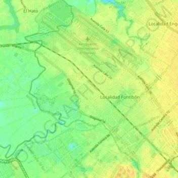
Name: Fontibón topographic map, elevation, terrain.

Location: Fontibón, Bogota, Bogota Capital District, Colombia (4.63737 -74.17696 4.72011 -74.10342)

Average elevation: 2,545 m

Minimum elevation: 2,531 m

Maximum elevation: 2,557 m

Gear up for your next adventure:

🔭Compact Hiking Binoculars - Lightweight optics for scouting terrain and spotting wildlife
🍲Portable Camping Stoves - Fast-boiling stoves for hot meals on remote topographic survey trips
🎒Hiking Child Carriers - Explore the outdoors with the whole family safely
🥤Hiking Water Bottles - Reusable bottles for hydration on the trail
🗺️Ordnance Survey Maps - Official UK maps for walking and outdoor activities

As an Amazon Associate, this site earns from qualifying purchases at no extra cost to you.