
Make a donation
Gear up for your next adventure:
As an Amazon Associate, this site earns from qualifying purchases at no extra cost to you.
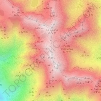
Sistema Central topographic map
Click on the map to display elevation.
Make a donation
Gear up for your next adventure:
As an Amazon Associate, this site earns from qualifying purchases at no extra cost to you.
Sistema Central
La mayor elevación del sistema es el pico Almanzor (2592 m sobre el nivel del mar), situado en la sierra de Gredos. La cordillera se subdivide en sierras separadas entre sí por grandes valles o puertos de montaña. De todas ellas, las más importantes por extensión son las siguientes, ordenadas de oeste a este: Estrella, Gredos, Guadarrama y Ayllón. La base de estas montañas oscila de los 500 a 1200 metros.
Make a donation
Gear up for your next adventure:
As an Amazon Associate, this site earns from qualifying purchases at no extra cost to you.
About this map
Name: Sistema Central topographic map, elevation, terrain.
Average elevation: 2,191 m
Minimum elevation: 1,472 m
Maximum elevation: 2,542 m
Make a donation
Gear up for your next adventure:
As an Amazon Associate, this site earns from qualifying purchases at no extra cost to you.