
La Sûre topographic map
Interactive map
Click on the map to display elevation.
About this map
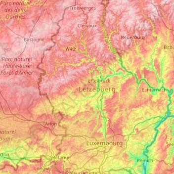
Name: La Sûre topographic map, elevation, terrain.
Location: La Sûre, Esch-sur-Sûre, Canton Wiltz, 9650, Luxemburg (49.71290 5.51472 49.93209 6.53105)
Average elevation: 369 m
Minimum elevation: 132 m
Maximum elevation: 583 m