
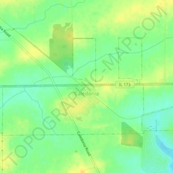
Caledonia topographic map
Interactive map
Click on the map to display elevation.
About this map
Name: Caledonia topographic map, elevation, terrain.
Average elevation: 284 m
Minimum elevation: 271 m
Maximum elevation: 296 m
Other topographic maps
Click on a map to view its topography, its elevation and its terrain.
Caledonia Township
United States > Illinois > Boone County
Caledonia Township, Boone County, Illinois, United States
Average elevation: 280 m
Belvidere
United States > Illinois > Boone County
Belvidere, Belvidere Township, Boone County, Illinois, 61008, United States
Average elevation: 244 m
Poplar Grove Township
United States > Illinois > Boone County
Poplar Grove Township, Boone County, Illinois, 61065, United States
Average elevation: 273 m