
Balice topographic map
Interactive map
Click on the map to display elevation.
About this map
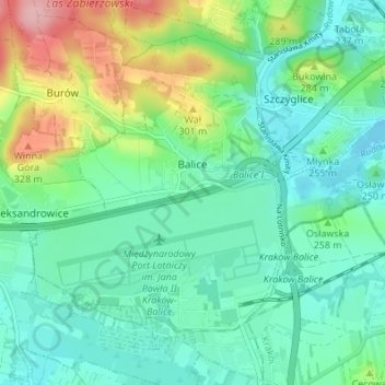
Name: Balice topographic map, elevation, terrain.
Average elevation: 254 m
Minimum elevation: 215 m
Maximum elevation: 359 m
Other topographic maps
Click on a map to view its topography, its elevation and its terrain.
Werychów
Poland > Lesser Poland Voivodeship > Kraków County > Balice
Werychów, Balice, gmina Zabierzów, Kraków County, Lesser Poland Voivodeship, 31-083, Poland
Average elevation: 238 m