Geolocate

Olango topographic map

Click on the map to display elevation.

About this map

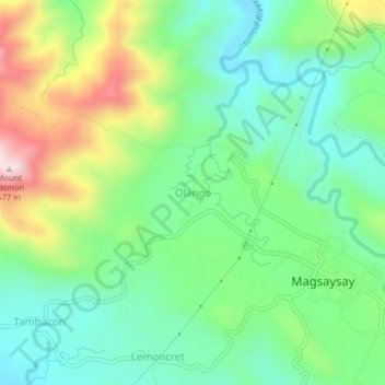
Name: Olango topographic map, elevation, terrain.

Location: Olango, Lanao del Norte, Northern Mindanao, 9221, Philippines (8.02398 123.87954 8.06398 123.91954)

Average elevation: 238 m

Minimum elevation: 85 m

Maximum elevation: 544 m

Gear up for your next adventure:

🗺️Scratch-off Peak Maps - Track your progress climbing Munros or Wainwrights
📸Action Camera Chest Mounts - Record your ascent following topographic paths hands-free
🔦Head Torches - Hands-free lighting for hiking and camping
💧Hydration Reservoirs - Convenient water bladders for hands-free drinking on the move
🔥Emergency Fire Starters - Reliable ignition tools for survival situations in damp conditions

As an Amazon Associate, this site earns from qualifying purchases at no extra cost to you.