
Offa topographic map
Interactive map
Click on the map to display elevation.
About this map
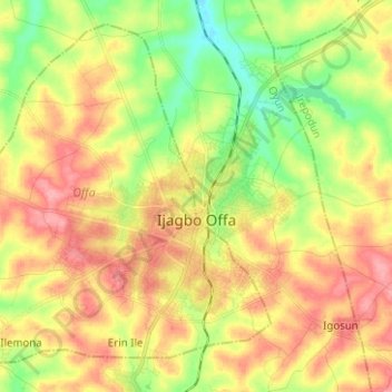
Name: Offa topographic map, elevation, terrain.
Location: Offa, État de Kwara, 250101, Nigéria (8.10801 4.62125 8.21744 4.74656)
Average elevation: 412 m
Minimum elevation: 364 m
Maximum elevation: 457 m
Other topographic maps
Click on a map to view its topography, its elevation and its terrain.