
Sucre topographic map
Interactive map
Click on the map to display elevation.
About this map
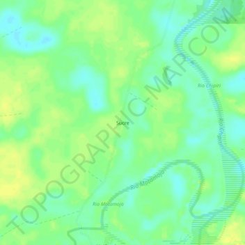
Name: Sucre topographic map, elevation, terrain.
Location: Sucre, Villa Tunari, Chapare, Cochabamba, Bolivia (-16.69681 -65.31992 -16.65681 -65.27992)
Average elevation: 201 m
Minimum elevation: 191 m
Maximum elevation: 210 m