
Gaganbavda topographic map
Interactive map
Click on the map to display elevation.
About this map
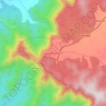
Name: Gaganbavda topographic map, elevation, terrain.
Location: Gaganbavda, Kolhapur, Maharashtra, 416006, India (16.52411 73.80843 16.56411 73.84843)
Average elevation: 469 m
Minimum elevation: 128 m
Maximum elevation: 767 m
Other topographic maps
Click on a map to view its topography, its elevation and its terrain.
Andur
India > Maharashtra > Gaganbavda
Andur, Gaganbavda, Kolhapur, Maharashtra, 416206, India
Average elevation: 615 m