
Orgeuil topographic map
Interactive map
Click on the map to display elevation.
About this map
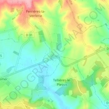
Name: Orgeuil topographic map, elevation, terrain.
Average elevation: 217 m
Minimum elevation: 173 m
Maximum elevation: 301 m
Other topographic maps
Click on a map to view its topography, its elevation and its terrain.
Les Landes
France > Normandie > Orne > Ferrières-la-Verrerie
Les Landes, Ferrières-la-Verrerie, Alençon, Orne, Normandie, France métropolitaine, 61390, France
Average elevation: 267 m