
Puthucode topographic map
Interactive map
Click on the map to display elevation.
About this map
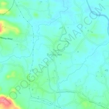
Name: Puthucode topographic map, elevation, terrain.
Location: Puthucode, Alathur, Palakkad District, Kerala, 678686, India (10.61392 76.42984 10.65392 76.46984)
Average elevation: 57 m
Minimum elevation: 39 m
Maximum elevation: 130 m
Other topographic maps
Click on a map to view its topography, its elevation and its terrain.
Kizhakkanchery
India > Kerala > Alathur > Kizhakkencherry
Kizhakkanchery, Kizhakkencherry, Alathur, Palakkad District, Kerala, India
Average elevation: 226 m
Mangalam Dam
Mangalam Dam, Alathur, Palakkad District, Kerala, 678683, India
Average elevation: 79 m