
Refugi d'Ulldeter topographic map
Interactive map
Click on the map to display elevation.
About this map
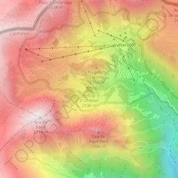
Name: Refugi d'Ulldeter topographic map, elevation, terrain.
Average elevation: 2,303 m
Minimum elevation: 1,698 m
Maximum elevation: 2,697 m
Other topographic maps
Click on a map to view its topography, its elevation and its terrain.
Valter2000
Espagne > Catalogne > Gérone > Valter2000
Valter2000, Setcases, Ripollais, Gérone, Catalogne, 17869, Espagne
Average elevation: 2,328 m