
Thank you for supporting this site ❤️
Make a donation
Make a donation
Gear up for your next adventure:
As an Amazon Associate, this site earns from qualifying purchases at no extra cost to you.
Tabor topographic map
Click on the map to display elevation.
Thank you for supporting this site ❤️
Make a donation
Make a donation
Gear up for your next adventure:
As an Amazon Associate, this site earns from qualifying purchases at no extra cost to you.
About this map
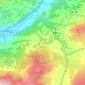
Name: Tabor topographic map, elevation, terrain.
Location: Tabor, Dolgellau, Gwynedd, Wales, LL40 2RA, United Kingdom (52.71972 -3.86728 52.75972 -3.82728)
Average elevation: 186 m
Minimum elevation: 7 m
Maximum elevation: 451 m
Gwynedd trails, hiking, mountain biking, running and outdoor activities
Thank you for supporting this site ❤️
Make a donation
Make a donation
Gear up for your next adventure:
As an Amazon Associate, this site earns from qualifying purchases at no extra cost to you.