
Kamala topographic map
Interactive map
Click on the map to display elevation.
About this map
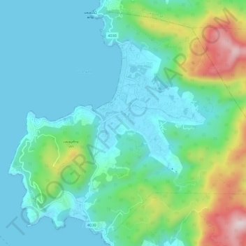
Name: Kamala topographic map, elevation, terrain.
Location: Kamala, Kathu, Phuket Province, Thailand (7.92161 98.25804 7.97088 98.31296)
Average elevation: 119 m
Minimum elevation: 0 m
Maximum elevation: 521 m
Other topographic maps
Click on a map to view its topography, its elevation and its terrain.