Geolocate

Peeploon topographic map

Click on the map to display elevation.

About this map

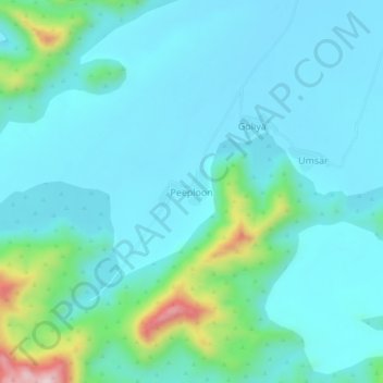
Name: Peeploon topographic map, elevation, terrain.

Location: Peeploon, Siwana Tehsil, Balotra District, Rajasthan, India (25.57337 72.36501 25.61337 72.40501)

Average elevation: 264 m

Minimum elevation: 200 m

Maximum elevation: 586 m

Gear up for your next adventure:

🍱Food Containers - Reusable containers for outdoor meals
🧦Hiking Socks - Breathable socks designed to prevent blisters on long walks
📱Rugged Phone Cases - Heavy-duty protection for smartphones used as secondary GPS tools
🔥Emergency Fire Starters - Reliable ignition tools for survival situations in damp conditions
📻Hand-Crank Emergency Radios - Stay updated on weather warnings in remote areas

As an Amazon Associate, this site earns from qualifying purchases at no extra cost to you.