
Le Bois - Porte de Nogent topographic map
Interactive map
Click on the map to display elevation.
About this map
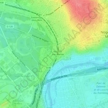
Name: Le Bois - Porte de Nogent topographic map, elevation, terrain.
Average elevation: 59 m
Minimum elevation: 34 m
Maximum elevation: 110 m
Other topographic maps
Click on a map to view its topography, its elevation and its terrain.
Port sous la Lune
France > Île-de-France > Nogent-sur-Marne
Port sous la Lune, Nogent-sur-Marne, Val-de-Marne, Île-de-France, France métropolitaine, 94130, France
Average elevation: 57 m