
Netphen topographic map
Interactive map
Click on the map to display elevation.
Netphen
Hainchen's area encompasses 10.7 km², 6.5 km² of which is wooded, with the rest made up of meadows and built-up areas. The boundary runs for roughly 8 km along the border with Hesse. As well, Hainchen borders on the town of Bad Laasphe in the north and in the south on the community of Wilnsdorf. The difference in elevation between the entrance to the community and the exit from it at the Hessian border is 96 m (384 to 480 m).
About this map
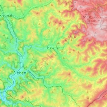
Name: Netphen topographic map, elevation, terrain.
Average elevation: 397 m
Minimum elevation: 218 m
Maximum elevation: 686 m