
Oxford topographic map
Interactive map
Click on the map to display elevation.
About this map
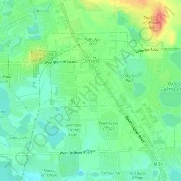
Name: Oxford topographic map, elevation, terrain.
Location: Oxford, Oakland County, Míchigan, Estados Unidos (42.81058 -83.27767 42.82933 -83.23791)
Average elevation: 319 m
Minimum elevation: 300 m
Maximum elevation: 354 m