
Perry Barr topographic map
Interactive map
Click on the map to display elevation.
About this map
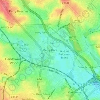
Name: Perry Barr topographic map, elevation, terrain.
Average elevation: 112 m
Minimum elevation: 89 m
Maximum elevation: 152 m
Other topographic maps
Click on a map to view its topography, its elevation and its terrain.
Roughley
United Kingdom > England > Birmingham > Sutton Coldfield > Little Sutton
Average elevation: 139 m
Black Pool
United Kingdom > England > Birmingham > Sutton Coldfield > Tyburn > Walmley Ash
Average elevation: 95 m
Banners Gate
United Kingdom > England > Birmingham > Sutton Coldfield > New Oscott
Average elevation: 144 m
Walmley Ash
United Kingdom > England > Birmingham > Sutton Coldfield > Walmley
Average elevation: 99 m
Brookvale Village
United Kingdom > England > Birmingham > Stockland Green > Brookvale Village
Average elevation: 111 m