
Haripur topographic map
Interactive map
Click on the map to display elevation.
About this map
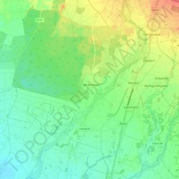
Name: Haripur topographic map, elevation, terrain.
Location: Haripur, Sarlahi, Madhesh Province, Nepal (26.96351 85.48977 27.06445 85.59970)
Average elevation: 112 m
Minimum elevation: 93 m
Maximum elevation: 146 m
Other topographic maps
Click on a map to view its topography, its elevation and its terrain.
Malangawa
Nepal > Madhesh Province > Sarlahi
Malangwa (Devanagari: मलंगवा) is a town, a municipality, and the headquarter of Sarlahi District in Madhesh Province of Nepal. The district's oldest municipality, it is in parliamentary constituency 2. From the Mahendra Highway 25 kilometres (16 mi) south of Nawalpur, a small highway side town.…
Average elevation: 83 m