Geolocate

Avio topographic map

Click on the map to display elevation.

About this map
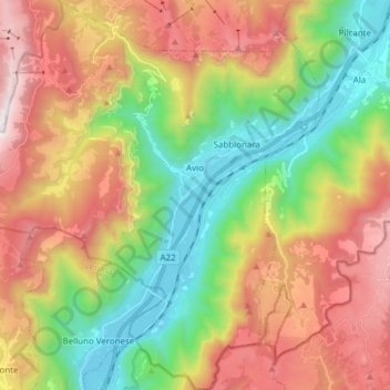
Name: Avio topographic map, elevation, terrain.

Location: Avio, Comunità della Vallagarina, Provincia di Trento, Trentino – Alto Adige/Südtirol, 38063, Italy (45.67287 10.84318 45.77967 10.98598)

Average elevation: 915 m

Minimum elevation: 114 m

Maximum elevation: 1,946 m

Other topographic maps

Click on a map to view its topography, its elevation and its terrain.

Gear up for your next adventure:

🧭Professional Hiking Compasses - High-precision liquid-filled compasses for map reading and orientation
📱Rugged Phone Cases - Heavy-duty protection for smartphones used as secondary GPS tools
📱Phone Mounts for Hiking - Secure mounts to carry your phone on trails
📚UK Hiking Guidebooks - Detailed route descriptions for the Lake District, Peaks, and Highlands
🧰First Aid Kits - Essential safety kits for outdoor activities

As an Amazon Associate, this site earns from qualifying purchases at no extra cost to you.