
Krumovgrad topographic map
Interactive map
Click on the map to display elevation.
About this map
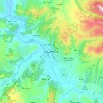
Name: Krumovgrad topographic map, elevation, terrain.
Location: Krumovgrad, Kardzhali, 6900, Bulgaria (41.43311 25.61463 41.51311 25.69463)
Average elevation: 333 m
Minimum elevation: 192 m
Maximum elevation: 711 m
Other topographic maps
Click on a map to view its topography, its elevation and its terrain.