Geolocate

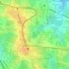
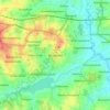
Byrathi topographic map

Click on the map to display elevation.

About this map

Name: Byrathi topographic map, elevation, terrain.

Location: Byrathi, Bengaluru East City Corporation, Bengaluru, Bangalore East, Bengaluru Urban, Karnataka, 560077, India (13.02198 77.64691 13.08199 77.69438)

Average elevation: 890 m

Minimum elevation: 870 m

Maximum elevation: 921 m

Other topographic maps

Click on a map to view its topography, its elevation and its terrain.
Whitefield

India > Karnataka > Bangalore East > Bengaluru

Average elevation: 875 m

Carmelaram

India > Karnataka > Bangalore East > Bengaluru

Average elevation: 890 m

Balagere

India > Karnataka > Bangalore East > Bengaluru > Balagere

Average elevation: 874 m

Varthur Lake

India > Karnataka > Bangalore East > Bengaluru

Average elevation: 869 m

Bileshivale

India > Karnataka > Bangalore East > Bengaluru

Average elevation: 887 m

Hoodi Lake

India > Karnataka > Bangalore East > Bengaluru > Sadaramangala

Average elevation: 889 m

Kodigehalli

India > Karnataka > Bangalore East > Bengaluru

Average elevation: 881 m

Gear up for your next adventure:

🔦Keychain LED Torches - Emergency backup light for finding gear in your pack
🥼Base Layers - Thermal base layers for temperature regulation
🪢Paracord - Multi-purpose cord for camping and survival
🎒Hiking Child Carriers - Explore the outdoors with the whole family safely
🛰️Outdoor GPS Navigation - Navigation devices for remote and off-grid areas

As an Amazon Associate, this site earns from qualifying purchases at no extra cost to you.