
长葛市 topographic map
Interactive map
Click on the map to display elevation.
About this map
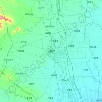
Name: 长葛市 topographic map, elevation, terrain.
Location: 长葛市, 建设路街道, 长葛市, 许昌市, 河南省, 中国 (34.05570 113.60767 34.37570 113.92767)
Average elevation: 103 m
Minimum elevation: 64 m
Maximum elevation: 460 m
西北高,东南低,呈缓倾斜状。地形大体分为浅山区、岗丘区和平原区三部分: