
Giessenbach topographic map
Interactive map
Click on the map to display elevation.
About this map
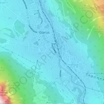
Name: Giessenbach topographic map, elevation, terrain.
Location: Giessenbach, Büel, Ennenda, Glarus, 8755, Schweiz (47.03669 9.07022 47.03743 9.07063)
Average elevation: 634 m
Minimum elevation: 468 m
Maximum elevation: 1,745 m