
Den of Lindores topographic map
Interactive map
Click on the map to display elevation.
About this map
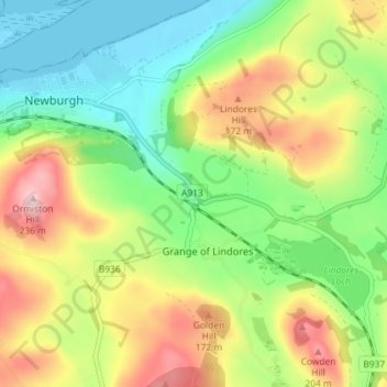
Name: Den of Lindores topographic map, elevation, terrain.
Average elevation: 93 m
Minimum elevation: -3 m
Maximum elevation: 230 m
Other topographic maps
Click on a map to view its topography, its elevation and its terrain.
Berryhill Farm
United Kingdom > Scotland > Fife > Grange of Lindores
Berryhill Farm, Grange of Lindores, Fife, Scotland, KY14 6HZ, United Kingdom
Average elevation: 112 m