Xã Tiến Thành topographic map
Interactive map
Click on the map to display elevation.
About this map
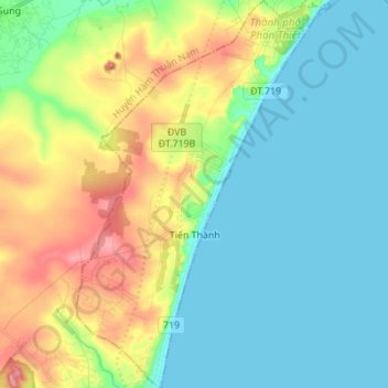
Name: Xã Tiến Thành topographic map, elevation, terrain.
Location: Xã Tiến Thành, Phan Thiết City, Binh Thuan province, Vietnam (10.77686 107.99280 10.91196 108.08055)
Average elevation: 43 m
Minimum elevation: 0 m
Maximum elevation: 145 m
Other topographic maps
Click on a map to view its topography, its elevation and its terrain.
Mũi Né
Vietnam > Binh Thuan province > Phan Thiết City
Mũi Né, Phan Thiết City, Bình Thuận Province, Vietnam
Average elevation: 58 m
Xã Phong Nẫm
Vietnam > Binh Thuan province > Phan Thiết City
Xã Phong Nẫm, Phan Thiết City, Bình Thuận Province, Vietnam
Average elevation: 7 m