
Chitungwiza topographic map
Interactive map
Click on the map to display elevation.
About this map
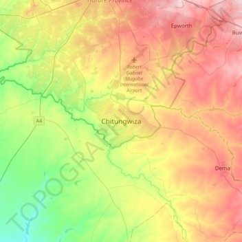
Name: Chitungwiza topographic map, elevation, terrain.
Location: Chitungwiza, Harare, Zimbabwe (-18.17435 30.91267 -17.85435 31.23267)
Average elevation: 1,438 m
Minimum elevation: 1,322 m
Maximum elevation: 1,574 m
Other topographic maps
Click on a map to view its topography, its elevation and its terrain.
Manyame River
Zimbabwe > Harare > Harare > Chitungwiza
Manyame River, Chitungwiza, Harare, Zimbabwe
Average elevation: 1,400 m