Geolocate

Springfield topographic map

Interactive map

Click on the map to display elevation.

About this map

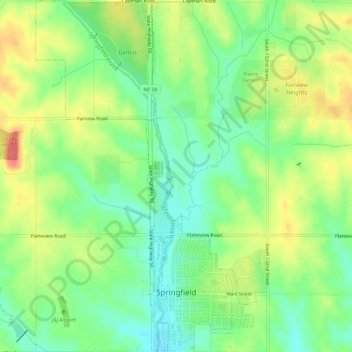
Name: Springfield topographic map, elevation, terrain.

Location: Springfield, Sarpy County, Nebraska, 68059, United States (41.07446 -96.15762 41.11816 -96.12123)

Average elevation: 344 m

Minimum elevation: 316 m

Maximum elevation: 381 m

Other topographic maps

Click on a map to view its topography, its elevation and its terrain.

Bellevue

United States > Nebraska > Sarpy County

Bellevue, Sarpy County, Nebraska, United States

Average elevation: 310 m

Sarpy County

United States > Nebraska > Sarpy County

Sarpy County, Nebraska, United States

Average elevation: 343 m