
Bali Gha topographic map
Interactive map
Click on the map to display elevation.
About this map
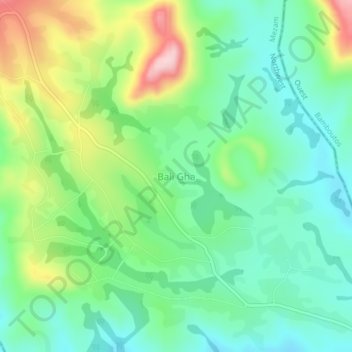
Name: Bali Gha topographic map, elevation, terrain.
Location: Bali Gha, Santa, Mezam, Northwest, Cameroon (5.72846 10.24611 5.76846 10.28611)
Average elevation: 1,261 m
Minimum elevation: 1,180 m
Maximum elevation: 1,430 m