
Yerba Buena topographic map
Interactive map
Click on the map to display elevation.
Yerba Buena
Yerba Buena is the capital of the Yerba Buena Department in the province of Tucumán, Argentina. It is located at an altitude of around 466 metres (1528 feet).
About this map
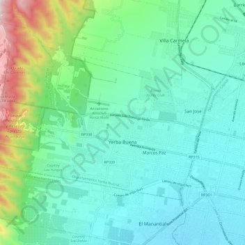
Name: Yerba Buena topographic map, elevation, terrain.
Average elevation: 591 m
Minimum elevation: 405 m
Maximum elevation: 1,297 m
Other topographic maps
Click on a map to view its topography, its elevation and its terrain.